 There
was agreement that the “Parallel Roads” of Glen Roy and adjacent valleys were
ancient beaches, notched into the side of the valleys.
There
was agreement that the “Parallel Roads” of Glen Roy and adjacent valleys were
ancient beaches, notched into the side of the valleys.EPISODE:
GLEN ROY, 1817-1821
There
was agreement that the “Parallel Roads” of Glen Roy and adjacent valleys were
ancient beaches, notched into the side of the valleys.
In 1817 John MacCulloch (1773-1835), President of The Geological Society of London, reviewed the origin of these striking features. He accepted the reality of the deluge, but pointed out that three terraces perhaps implied three deluges. He argued that even one deluge (which he thought of as a flow of water – a torrent) could not have produced a single line in Glen Roy because the lines are horizontal but the cross-section of the valley is irregular. Further, how could there be one line common to both Glen Roy and Glen Spean, but the upper two in Roy do not extent into Spean? And how could there be a line of the same height in Glen Gloy with no other connection to the other two? Having explored various other difficulties he concluded: “I shall not pursue the consequences of this hypothesis [a deluge] further. Every person's imagination can supply additional difficulties, which it would be tedious to follow to their ultimate ramifications.” He then argued that the lines must have been produced by temporary lakes which occupied the valley at different levels: “The absolute water level which is found to exist between the corresponding lines both in Glen Roy and in those vallies which communicate with it, admits of a ready solution, on the supposition that a lake once occupied this set of vallies; . . . If however a lake be considered the cause, it is plain that the lines in question were once the shores of this lake; and it equally follows that it had existed at three different elevations.” But he could not think of what might have dammed the valley. He argued against a marine incursion as there were no shells to be found in Glen Roy and, besides, why would the terraces not be more widespread?
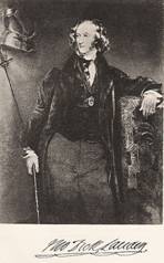 Thomas Dick Lauder [Lauder Dick] (1784-1848), in
1818, had come to much the same conclusion, adding that the different levels
were related to mountain passes (cols) at different altitudes across which the
lakes must have drained at different times.
Thomas Dick Lauder [Lauder Dick] (1784-1848), in
1818, had come to much the same conclusion, adding that the different levels
were related to mountain passes (cols) at different altitudes across which the
lakes must have drained at different times.
QUESTIONS:
REFERENCES
Lauder T.D. [T. Lauder Dick] 1823 (read 1818) On the parallel roads of Lochaber. Transactions of the Royal Society of Edinburgh v.9 p.1-64 http://books.google.com/books?id=zfYQAAAAIAAJ&pg=PA1-IA4#v
[SUMMARY REPORT: The Journal of Science and the Arts no.IX, v.V (1818), p.175-177 http://books.google.com/books?id=J-k4AAAAMAAJ&pg=PA175 ]
MacCulloch J. 1817 On the Parallel Roads of Glen Roy Transactions of the Geological Society of London v. 4, p. 314-392 http://www.google.com/books?id=1ybPAAAAMAAJ&pg=PA314
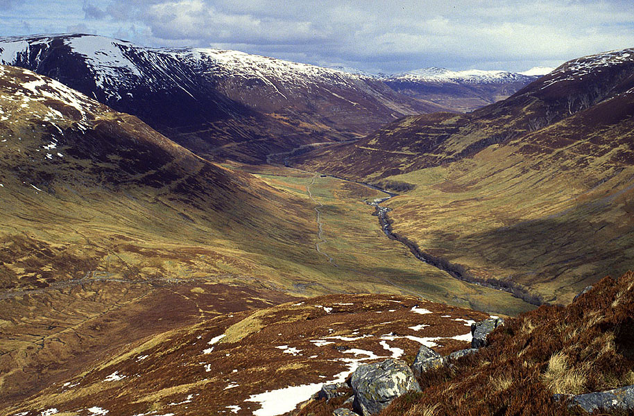
THE “PARALLEL ROADS” OF GLEN ROY
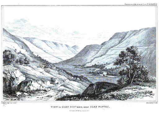
MacCulloch 1817, Plate 16: "View in Glen Roy"

http://www.swisseduc.ch/glaciers/earth_icy_planet/icons-15/16-glen-roy.jpg
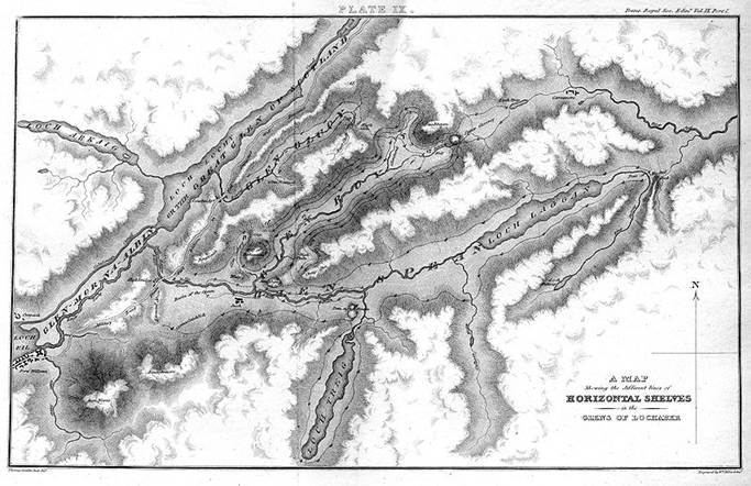
Dick Lauder's map of the "Horizontal Shelves of the Glens of Lochaber" (1818)
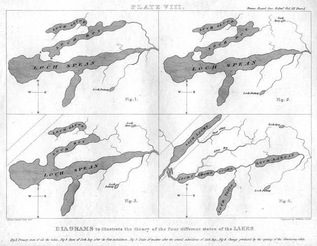
Dick Lauder's "Diagrams to illustrate the theory of the four different states of the lakes" (1818)